
SBAS for Precise Positioning: FJD AG1 Requires No Network or Base Station
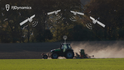
Satellite navigation systems alone cannot meet the needs of some applications with high positioning accuracy. Therefore, the Satellite-Based Augmentation Systems (SBAS) come into being. It presents a huge opportunity for precision agriculture practices as it can enhance the efficiency, productivity and sustainability of agricultural operations. The FJD AG1 Guidance System uses this technology to achieve an accuracy of 20–50 cm without a network or base station.
What is SBAS?
SBAS is a well-developed technology that can transmit a variety of augmentation information to users through the geostationary satellite (GEO) equipped with navigation payloads in charge of transmitting signals. The information transmitted includes correction for ephemeris error, satellite clock error and ionospheric delay, which are utilized to improve the accuracy, integrity, and availability of satellite navigation system.
Many SBAS systems have been established in the world, such as WAAS in the United States, EGNOS in Europe, MSAS in Japan, and GAGAN in India.

What is the Difference Among GNSS, GPS and SBAS?
Global Navigation Satellite Systems (GNSS) are satellite-guided systems that provide positioning, navigation, and timing (PNT) information anywhere on the Earth. GPS, GLONASS, BeiDou, and Galileo are examples of GNSS. Each system operates using a network of satellites that transmit signals to receivers on the ground. SBAS is a supplementary system designed to improve the performance and accuracy of GNSS signals, primarily for aviation applications.
Here’s a breakdown of the differences among GNSS, GPS, and SBAS:
| Feature | GNSS | GPS | SBAS |
| Definition | A generic term for global and regional satellite-based navigation systems. | A satellite-based radio navigation system developed and operated by US | A supplementary system that enhances the performance and accuracy of GNSS signals |
| Examples | GPS (US), GLONASS (Russia), BeiDou (China), Galileo (Europe), IRNSS (India), QZSS (Japan) | N/A (GPS itself is a GNSS) | WAAS (US), EGNOS (Europe), MSAS (Japan), GAGAN (India) |
| Number of Satellites | Varies by system: typically from 24 to more than 30 satellites | 24 to 32 satellites in MEO | Uses geostationary satellites to relay correction information (number of satellites varies by system) |
| Primary Use | PNT information for various applications, including navigation, agriculture, surveying, and disaster management | PNT information for civilian and military users around the world | Primarily used to improve GNSS accuracy, integrity, and availability for aviation applications |
| Coverage | Global or regional, depending on the system | Global coverage | Regional coverage; usually serves a specific continent or large geographic area |
| Accuracy | Varies by system, but typically between 5 and 15 meters | 4.9 meters for civilian users, better for military users | Improves GNSS accuracy to around 1-2 meters in certain cases |
| Infrastructure | A network of satellites and ground control stations specific to each system | 24 to 32 MEO satellites and a global network of ground control stations | Ground monitoring stations, processing centers, and geostationary satellites to transmit correction data |
How Does SBAS Help FJD AG1 Achieve Precise Positioning?
SBAS uses GNSS measurements taken by accurately located reference stations deployed across an entire continent. All measured GNSS errors are transferred to a central computing center, where differential corrections and integrity messages are calculated. These calculations are then broadcast over the covered area using geostationary satellites that serve as an augmentation, or overlay, to the original GNSS message.

By improving the accuracy of GNSS signals, SBAS enables the FJD AG1 Guidance System to achieve an accuracy of 20–50 cm without a network or base station. Therefore, farmers can use FJD AG1 more effectively for planting, irrigation, fertilization, etc., which will not only help reduce input costs, increase crop yields, and minimize environmental impacts, but also enhance the efficiency and sustainability of agricultural operations.
Other products that utilize the SBAS technology include FJD AT1 Autosteering Kit, FJD AT2 Auto Steer System, and FJD AH1 Hydraulic Autosteering Kit.
References:
https://frontiersi.com.au/project/what-is-sbas/
https://mapscaping.com/difference-between-gnss-gps-and-sbas/
https://www.euspa.europa.eu/european-space/eu-space-programme/what-sbas
in Technology
# FJD AG1 Guidance System FJD AH1 Hydraulic Autosteering Kit FJD AT1 Autosteering Kit FJD AT2 Auto steer system Precision Agriculture